

Historical reports describe scheelite hosted in quartzite. Sangdong is a geological comparison only: its bedding-conformable tungsten horizons do not establish equivalent grades, resources or mine economics at Five T's.[30][31][9][8]
Five tungsten occurrences along a 10 kilometre belt, all five on Allegiance ground. Canada Tungsten mapped 9,900 hectares of the surrounding district in 1972 and recorded scheelite in skarn, veins and shears across it.[30][31][9]
Eighteen of eighteen historical soil and silt samples anomalous in tungsten, from 95 to 1,600 ppm against a background of one to two. A 300 by 500 metre anomaly above 200 ppm is open in every direction because the survey ended before it did.[30][31][9]
Rock sampling to 1.54 percent WO₃ on a zone separate from the main trend, on the eastern claim boundary. Two mineralised zones confirmed. The belt between them untested.[30][31][9]
An 800 metre north-trending mineralised zone, 10 to 15 metres wide, runs through the Ice ground and carries the scheelite-bearing quartzite with it. Traced by the British Columbia Geological Survey in 2000, and open along strike in both directions.[30][31][9]
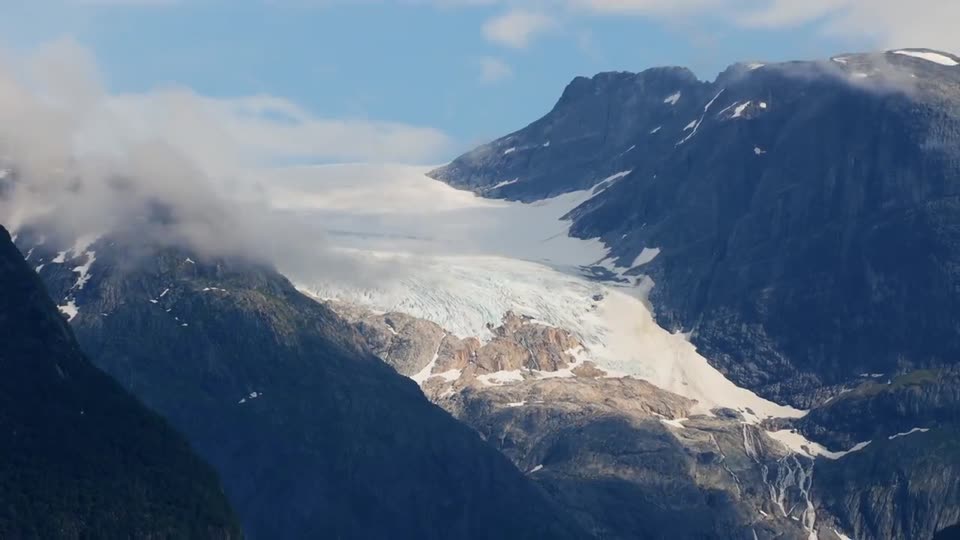
The Five T's project comprises ten mineral cell claims totalling 711.10 hectares over five recorded tungsten occurrences along a 10 kilometre northwest trending belt at the head of Albert Creek, 36 kilometres east of Revelstoke, British Columbia. Elevations run from 950 to 2,350 metres in the Selkirk Mountains between the Justice Glacier and the Primrose Icefield.[30][31][9]
The Ice occurrence is the principal target. An 800 metre north-trending mineralised zone, 10 to 15 metres wide, runs through the ground and is open along strike at both ends. Within it, scheelite occurs disseminated through quartzite traced over 420 metres of strike at 3 to 20 metres wide and open at both ends, with a coincident soil anomaly that remains open, and the 1986 filing records further strataform scheelite zones of undetermined size elsewhere on the claims. Four kilometres northwest, the EX 90 occurrence hosts scheelite skarn and molybdenite at the contact of the Albert Stock. Three further occurrences form a cluster at the western end of the belt.[30][31][9]
The featured project covers five historical occurrences along the belt and the ground between them. The proposed acquisition is pending exchange review and approval and has not closed.[30][31][9]
Location and infrastructure
36 kilometres east of Revelstoke and 16 kilometres south of the Trans-Canada Highway at Albert Canyon. Revelstoke provides full services, a regional airport and a helicopter base. The Revelstoke generating station is within 40 kilometres and the Mica station lies further up the Columbia. The CPKC mainline runs through Albert Canyon. The upper occurrences are helicopter accessible from July to September.[30][31][9]
| Year | Operator | Work | Result |
|---|---|---|---|
| 1971 | Union Carbide Canada Mining Ltd. | Staking of 60 Ice claims; geological mapping; ultraviolet night lamping; petrography | Scheelite-bearing quartzite zone traced 1,400 feet along strike, 15 to 40 feet wide. Scheelite and wolframite confirmed. Assessment report 3725.[30][31][9]Sources for this historical record row. |
| 1972 | Canada Tungsten Mining Corp. | Regional mapping, 9,900 hectares, ten claim groups, Albert Canyon district | Multiple scheelite occurrences in skarn, veins and shears across the district. Battle Range Batholith identified as the mineralising intrusion. Assessment report 3940.[30][31][9]Sources for this historical record row. |
| 1985 | Active Minerals Ltd. (C. Graf, P.Eng.) | Prospecting; rock, soil and silt geochemistry | Rock to 1.544% WO₃. Soils and silts 95 to 1,600 ppm W. Scheelite hosted in quartzite. Assessment report 14749.[30][31][9]Sources for this historical record row. |
| 2000 | British Columbia Geological Survey (J.M. Logan) | Regional gold reconnaissance | Gold-directed sampling of the intrusive contact and cross-cutting veins. Geological Fieldwork 2000.[30][31][9]Sources for this historical record row. |
No exploration work has been filed on the ground since 1986 and no hole has ever been drilled on it.[30][31][9]
Geology
The belt is underlain by Lower Cambrian and younger quartzites, quartz-mica schists, biotite schists and thin siliceous marble of the Hamill and Lardeau Groups, within a Cretaceous contact aureole between the Albert Stock to the west and the Battle Range Batholith to the east. Two folding events produced a dominant north-south foliation. The Ice zone lies along the axial trace of a major antiform.[30][31][9]
Canada Tungsten identified the Battle Range Batholith as a specialised granite with greisen and pegmatite phases, and interpreted it as the source of the tungsten, molybdenum and tin mineralisation across the district. Tin occurs at McDougal Creek, 5 kilometres east of the Ice zone.[30][31][9]
Mineralisation
Scheelite at the Ice zone is disseminated through a competent quartzite unit within the schist sequence, as coarse platy masses to 12 millimetres concentrated on north-striking fractures at 0.3 to 0.6 metre spacing and as finer disseminations through the host. Scheelite, wolframite, fluorite and carbonate occur as interstitial phases. The zone is north-trending, steeply west-dipping and 10 to 15 metres wide, traced by the British Columbia Geological Survey for 800 metres and open along strike at both ends. East-trending quartz-pyrite-muscovite veins carrying disseminated scheelite cut the stratabound zone.[30][31][9]
Historical assessment reports describe scheelite in quartzite at the Ice zone. Sangdong, Korea, is a geological comparison: its technical report describes bedding-conformable tungsten horizons, and Almonty reports an average ore grade of approximately 0.51 percent WO₃. Almonty describes it as one of the world's largest and highest-grade tungsten deposits. Geological similarity is not evidence of equivalent resources, grades, production potential or economics at Five T's.[30][31][9][8]
Rock, 1985. Seven grab samples along the Ice zone: 0.03 to 0.64 percent WO₃. One sample from a separate zone on the eastern boundary: 1.54 percent WO₃. Bismuth to 403 ppm and copper to 596 ppm accompany the tungsten.[30][31][9]
Soils and silts, 1985. Eighteen samples: 95 to 1,600 ppm tungsten, mean above 500 ppm. Six C-horizon soils define a 300 by 500 metre area above 200 ppm. Open in all directions.[30][31][9]
Night lamping, 1971. Scheelite-bearing quartzite traced 1,400 feet along strike, 15 to 40 feet wide, at the limit of the survey. Active Minerals mapped the largest known scheelite zone at 420 metres by 3 to 20 metres in 1985. The British Columbia Geological Survey traced the enclosing mineralised zone for 800 metres in 2000.[30][31][9]
Historical results were collected and reported by operators unrelated to Allegiance Resources Corp. The Company has not verified these results and is not treating any of them as a current mineral resource or mineral reserve.
800 metres of mineralised rock, 10 to 15 metres wide, open along strike at both ends, carrying 420 metres of traced scheelite-bearing quartzite that is itself open at both ends. The ten 25 metre channel samples specified in 1985 are the first order of work.[30][31][9]
300 by 500 metres above 200 ppm tungsten, defined by six samples, open in all directions. The grid has never been extended.[30][31][9]
The host quartzite runs for kilometres north and south of the Ice zone. Five kilometres of prospecting and geochemistry along strike is scheduled for 2027.[30][31][9]
Planned programme
Ten channel samples across the Ice zone. Soil grid extension until the anomaly closes.
Five kilometres of mapping and ultraviolet prospecting along the host unit.
Sampling along the mineralised zone, the eastern zone and the western cluster. Drill targets.
Thanksgiving
16.2% WO₃ at surface and 4.74% WO₃ over 2.03 metres in the drill, on a paved highway